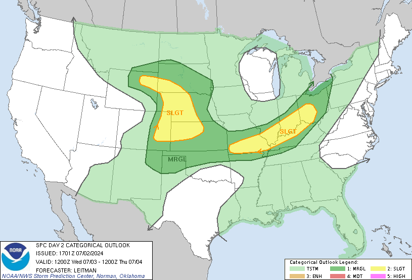
Severe storms capable of damaging wind and hail are expected
Wednesday across parts of Texas, Oklahoma and Kansas during the day,
developing into eastern Texas, Arkansas and northern Louisiana
overnight.

Moderators: carlson1, Charles L. Cotton

SPC maintains a Risk Level 3 for this afternoon & evening for North Texas, including the DFW Metro area.
All modes of Severe are possible this Afternoon and tonight - multiple rounds likely.
A complex and conditional situation will be apparent later today as we will have a CAP that will be in place early afternoon inhibiting initial storm formation. If the CAP erodes, as NWS expects, the mid-afternoon storms may start very quickly.
If this occurs, the reaction time may be tight with rapid development.
At this early-day view we might have 2-3 separate rounds of storms, in or near the [mid cities] area, starting as early as ~15:00 thru midnight tonight.
Most Likely Threats:
1) Severe to Giant Hail (Softball size)
2) Damaging winds to 70mph
3) Low end Tornado Risk (currently)
Probability of storm coverage is in the ~50-80% range 15:00 - 24:00 with “Destructive Hail” being the primary concern. A few Tornadoes are possible through multiple rounds of severe weather, in Supercell and line segment modes. Damaging winds possible.
Tarrant County has already alerted storm spotters to be prepared for this evening into early tomorrow.kayt00 wrote: Wed Apr 17, 2019 11:22 am I guess the risk is still very high as I just got notification that Collin College is closing up shop at 1pm today and all afternoon and evening classes have been cancelled.
Bottom Line
Some strong to severe storms are expected across the area this afternoon and into the night.
Overview
The forecast remains similar to the last couple of days: severe weather is likely across the region from mid-afternoon to mid-evening. The exact timing, severe weather hazards, and coverage depends on your location, and the image below should help provide more specific detail. A summary of the 3 areas of concern this afternoon and tonight is given here:
Eastern areas (east of Bonham, Corsicana, Hearne line) after 3 pm will be the first region of concern. This area looks like it has the highest potential for significant tornado activity, but it’s also the region where we are the least confident severe storms will be able to develop. Any storms that do develop in this area during the mid-late afternoon hours will have the potential to produce very large hail (baseball size) and damaging winds as well.
After 5 pm, areas west and northwest of the DFW Metroplex look to get active with storms firing on a dryline and moving east toward and through the I-35 corridor. Very large hail (greater than baseball size is possible with any storms that mature in this area). While the threat for tornadoes is lower in this area, brief isolated tornadoes can’t be ruled out. There is a low chance that the tornado potential could increase after 8 pm, particularly if storms are still not in a line and remain relatively separated.
After 9 pm, a strong upper level disturbance and a cold front will result in a squall line of storms developing in western areas and racing eastward during the overnight hours. The severe weather threat with the line looks greatest for areas south of I-20. This line will be capable of mainly damaging winds and possibly brief embedded tornadoes. Hail potential will be lower with the line, but up to ping pong ball size will be possible.
The flood potential will be limited by the scattered nature of storms and a fairly fast storm motion, but isolated instances of flash flooding are still a possibility, especially for areas that have had more than 3 inches of rain in the last 10 days.
What We Are Certain Of:
Some type of severe weather is likely across North and Central Texas.
Hail will be the primary hazard, with some significant hail exceeding 3 inches possible.
Sometimes with a dryline setup there can be uncertainty about the “cap” and whether storms will be able to develop. For this event, confidence is high the cap will be broken (at some point late this afternoon or tonight) and that storms will occur.
A squall line of storms is likely to impact areas south of I-20 tonight.
What We Are Less Certain Of:
The tornado potential is still uncertain. The tornado potential looks highest in eastern areas late this afternoon, but storm development is most uncertain in that area at that time. Likewise, there’s a small potential that the tornado threat could increase near the DFW Metroplex after 8 pm, particularly if storms can remain separated.